
Hurricane Hillary (2023) is expected to bring heavy rainfall to the southwestern U.S. and parts of California from the 20th through early next week, making it unusual for a hurricane to pass through the region, and the first tropical storm warning has been issued for southern California, which could bring more than a year’s worth of rainfall to parts of California, Nevada and Arizona.
The U.S. media reported that if it makes landfall in California, it would be the first time in 84 years and extremely unusual.
[Windy.com] Hurricane Tracker displays hurricane forecasts
To view hurricane forecasts on Windy.com, use the Hurricane Tracker.
To use the Hurricane Tracker, click on the icon in the upper right corner of the screen, just below the button labeled “3D”.
You will then be taken to the Hurricane Tracker screen, where hurricane information is overlaid.
Hurricane Tracker provides up-to-date information on tropical cyclones in the Atlantic, Eastern Pacific, Western Pacific, Indian Ocean, and Southern Hemisphere, view tracking charts, check forecasts to get the latest location and intensity, or view satellite images.
![[Windy.com] Hurricane Tracker displays hurricane forecasts](https://windy2023.com/wp-content/uploads/2023/08/image10.jpg)
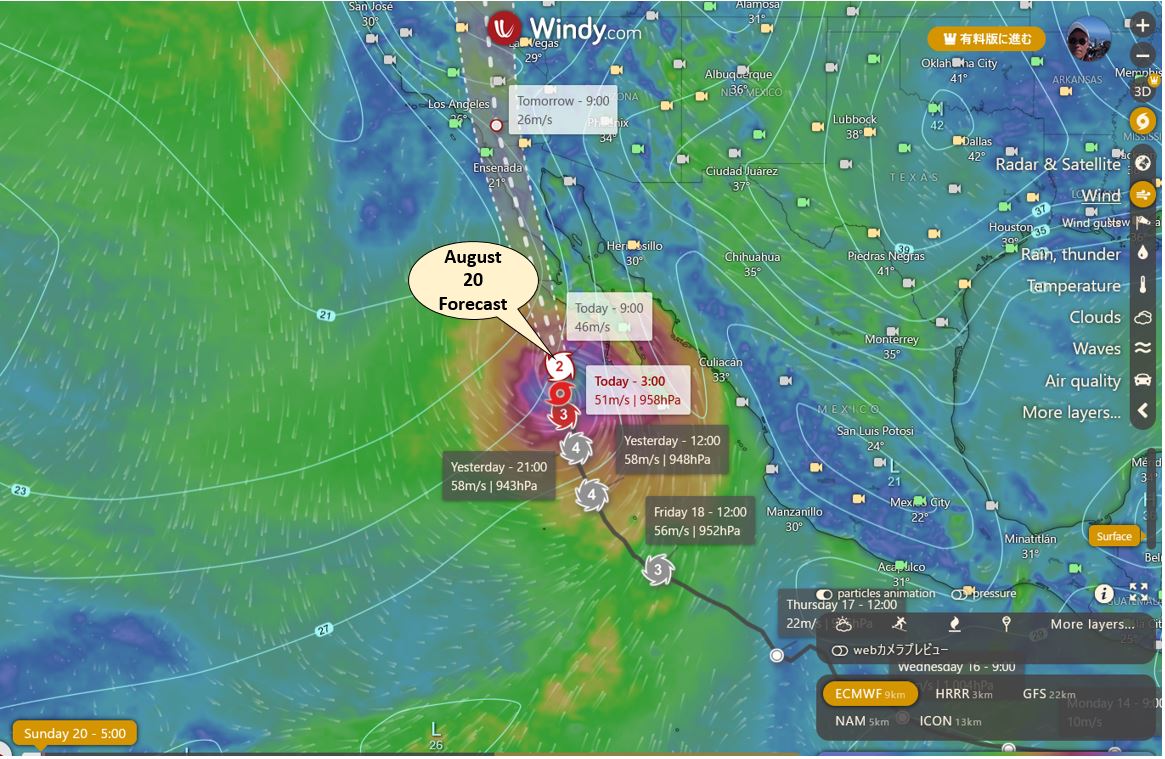
[Windy.com] Forecast for Hurricane Hillary (2023)
Today, as of August 18, 2023, according to the U.S. National Hurricane Center (NHC), Hurricane Hilary (Hilary) 2023 is currently in the southwest ocean of Mexico, moving west-northwest at 22 km/h.
When viewing the Hurricane Tracker, the left side displays a list of hurricanes and tropical storms that are currently developing.
Click on Hurricane Hillary (2023) as an example to see the forecast below.
![[Windy.com] Forecast for Hurricane Hillary (2023)](https://windy2023.com/wp-content/uploads/2023/08/image11.jpg)
Hurricane Check time lapse
Windy.com predicts the movement of the wind from now to 10 days from now.
At the bottom of the screen is a timescale starting from the present time, and clicking the play button shows how the wind direction and strength will change in the future.
The animation is also available in the Hurricane Tracker mode, so it is easier to visualize by superimposing it on the projected path map.
Below is the August 20 path forecast for Hurricane Hillary (2023).
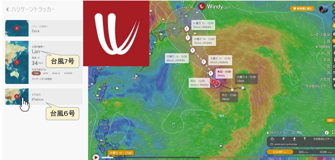
Hurricane Forecast Track Differences by Weather Forecast Agencies
In the list of hurricane trackers, there are four buttons: JMA, UKM, BoM-A, and ECMWF.
By switching between these buttons, you can see the differences in Hurricane path forecasts by weather forecasting agency.
JMA
Japan Meteorological Agency
BoM-A
Bureau Of Meteorology Australia
ECMWF
European Centre for Medium-Range Weather Forecasts
UKM ( United Kingdom Meteorological )
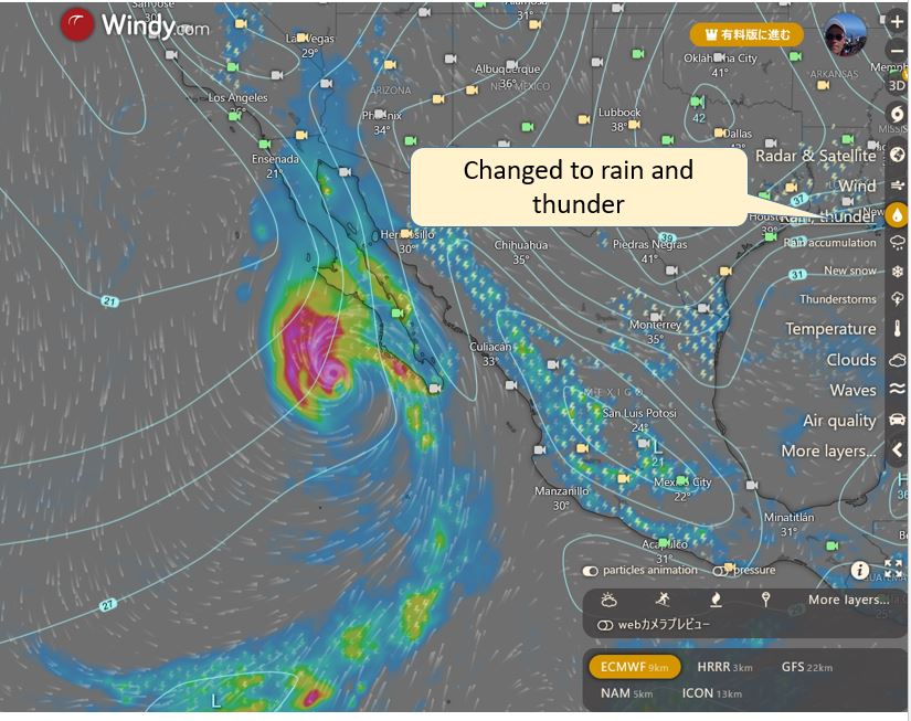
Forecasted hurricane rainfall
Windy.com’s default display is wind, but by selecting “Rain, Lightning” from the icons on the right side of the screen, you can also view rainfall forecasts.
Recently, floods and landslides have been occurring around the world due to global warming, and especially during hurricanes, a great deal of rainfall is expected, so please use Windy.com to check the forecast in advance.
Below is the display when the mode is changed from wind to rain and thunder.
[Windy.com] Hurricane Tracker to pre-check hurricanes!
Windy.com] Check the path of hurricanes and rainfall with the Hurricane Tracker and prepare for disasters in advance.
The mobile version also provides valuable information, so please use it in conjunction with TV and other weather information for disaster prevention.
コメント